A collection of photographs documenting the places, history, and heritage of Marion County.
Images are grouped thematically: places, historical scenes, and notable figures.
Places
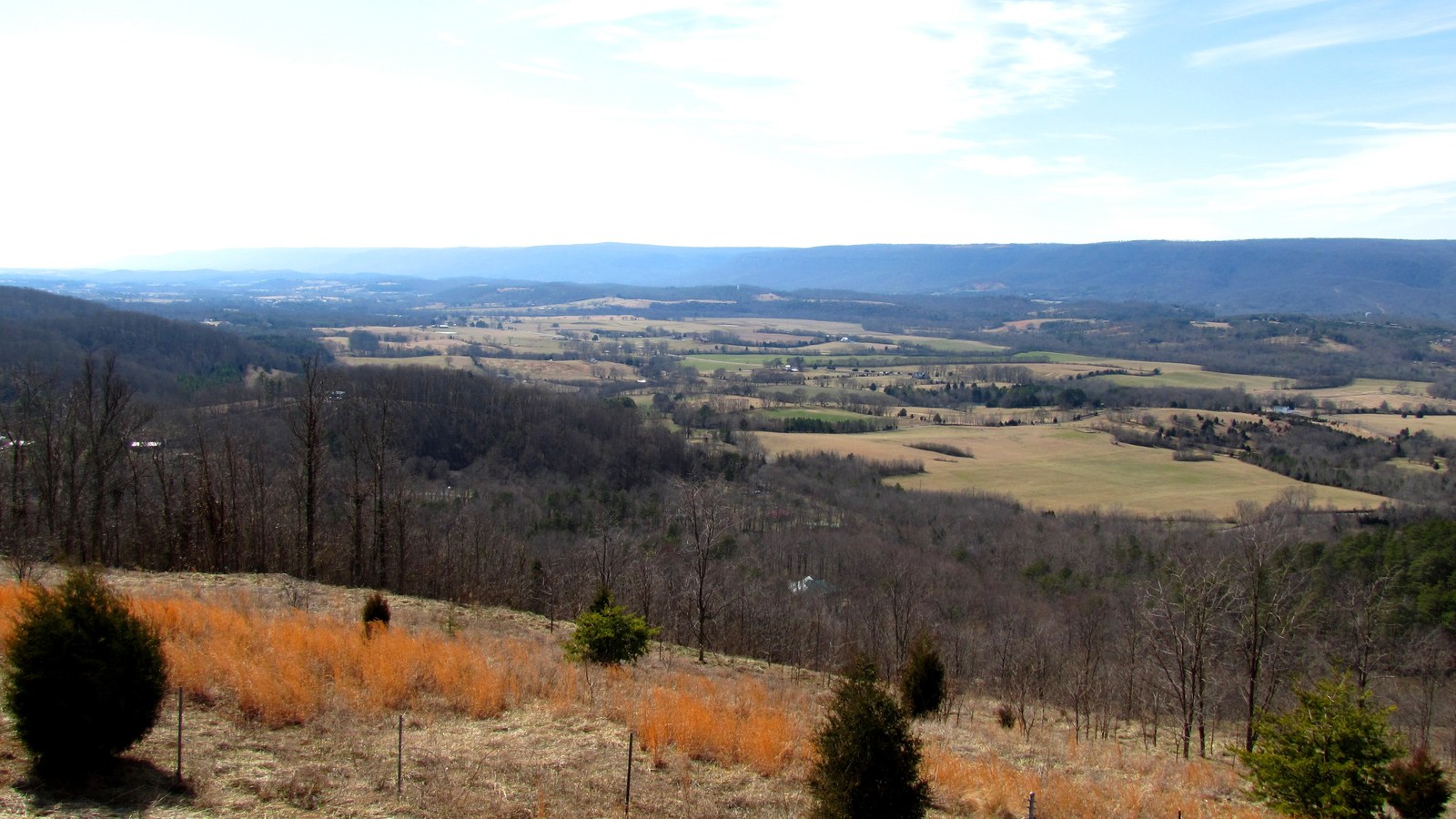
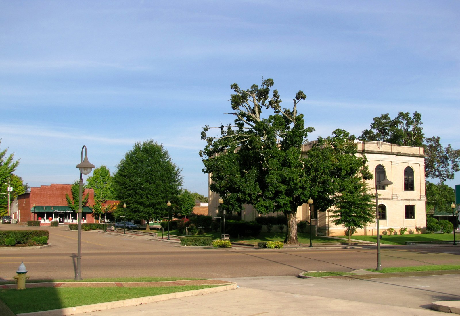
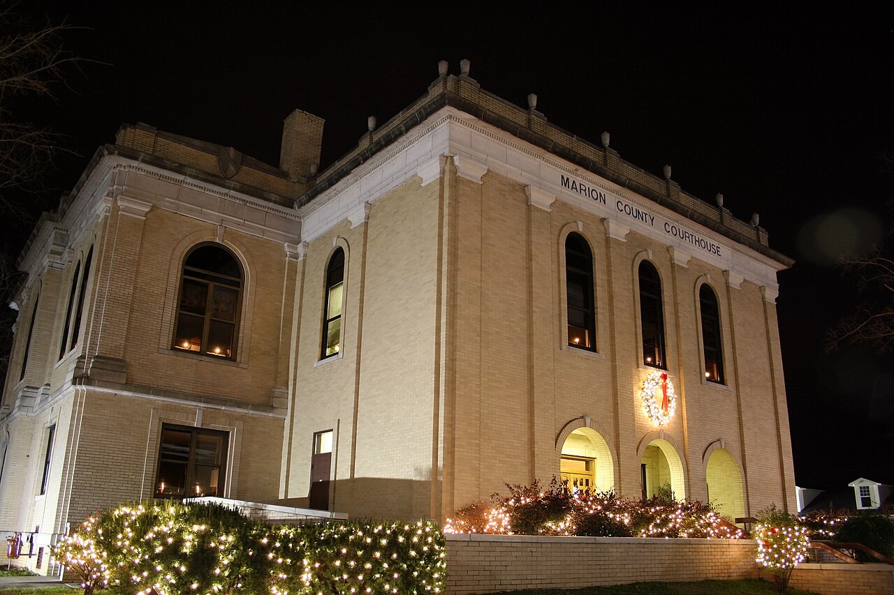
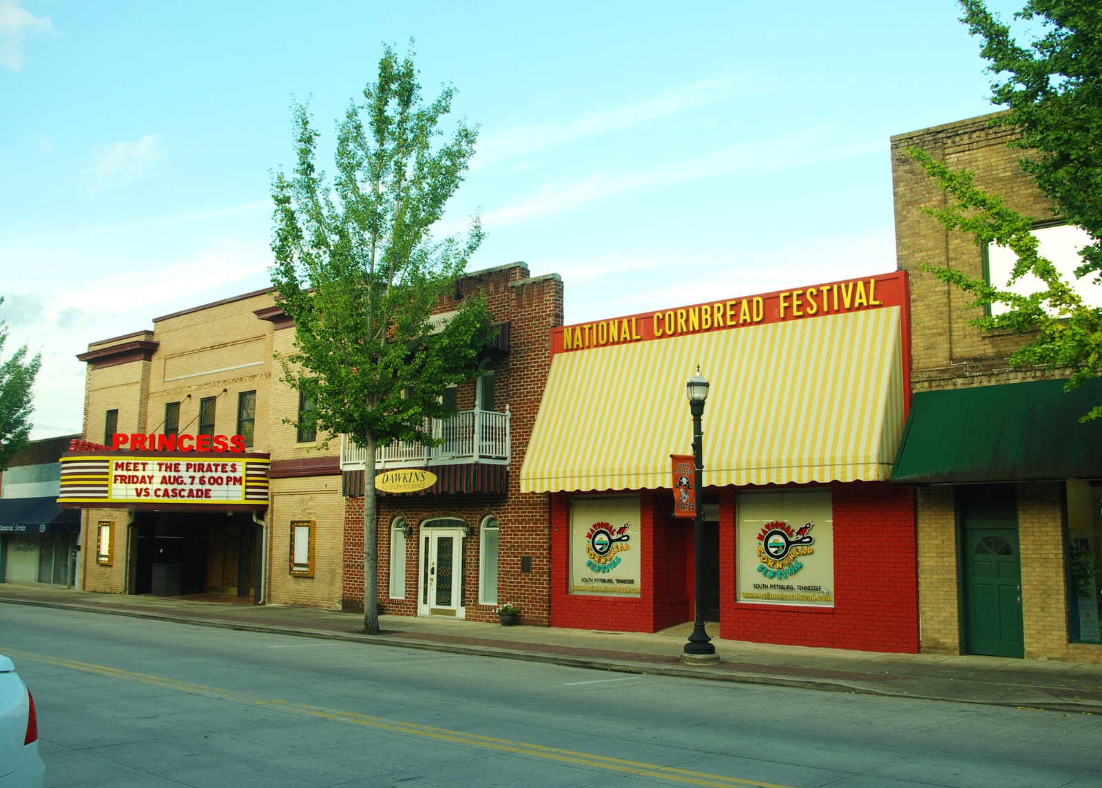
Sequatchie Valley Overlook: The heart of Marion CountyJasper Courthouse Square: County seat and civic centerThe Marion County Courthouse, completed in the mid-1920s after the 1922 fire. Photo: Tholcomb, CC BY-SA 3.0.South Pittsburg City Hall, built in 1887 as the First National Bank. NRHP-listed. Photo: Brian Stansberry, CC BY 3.0.South Pittsburg Princess Theatre: Historic entertainment venueWhitwell & the Cumberland Plateau: Mountain town backdropMonteagle Assembly Entrance: Historic mountain retreatOrme Railroad Depot: Connection to the NC&StL RailwayPowells Crossroads Town Hall: Small-town governanceTennessee River Gorge: Mathew Brady photograph, 1860sNickajack Cave: Historic cave with archaeological and cultural significanceNickajack Lake: TVA reservoir and recreation areaFoster Falls: Waterfall and natural heritage siteCumberland Trail: Long-distance hiking trail through Marion CountyWalls of Jericho (Tennessee side, 2016): The falls at the limestone box canyon at the Tennessee–Alabama line, reached on the TN trailhead in James D. Martin Skyline WMASequatchie River near Whitwell: The valley's namesake waterway in Marion CountyTennessee River Gorge: View from Julia Falls Outlook, 2023Gray Bat Colony: Endangered gray bats (Myotis grisescens) at roostFoster Falls (1939): TVA photograph of the 60-foot waterfall on the Cumberland PlateauNickajack Lake from Sand Mountain (2013): Looking across the Tennessee River Gorge toward the north rim, where Mullins Cove lies below Raccoon MountainNickajack Lake from TN-377 (2016): Plateau-rim view of the lake with the Tennessee State Route 156 causeway crossing below; the same ridgeline carries Aetna Mountain Road up to the hamlet inlandHales Bar Road at Haletown (2016): North-bank river road opposite the former Ladd worker village, threading between Nickajack Lake and the gorge wallsGriffith Creek at TN-108 (2015): The plateau-bench creek that gives the small Cumberland Plateau community of Griffith Creek its name, along the TN-108 corridor between Whitwell and PalmerTN-108 near Palmer (2015): The plateau-bench road corridor that carries TN-108 north out of Marion County toward southern Grundy County, threading the small communities of Griffith Creek and PalmerTennessee River Gorge from Julia Falls Outlook (2023, alternate view): A second look down the gorge from the outlook in Prentice Cooper, near the stretch where Suck Creek enters the river from the north bankRural Marion County farm (2014): Small-farm landscape representative of the plateau coves and Sequatchie Valley bottomlands, including the country around Ladds Cove at the Battle Creek headwatersTN-28 and TN-283 at Whitwell (2015): The Sequatchie Valley road corridor through Whitwell, the spine that runs south past Mineral Springs at the lower end of the valleySequatchie Valley from a Marion County ridge (2010): View out over the same Sequatchie Valley that Jasper Highlands fronts from the Jasper Mountain rim
History
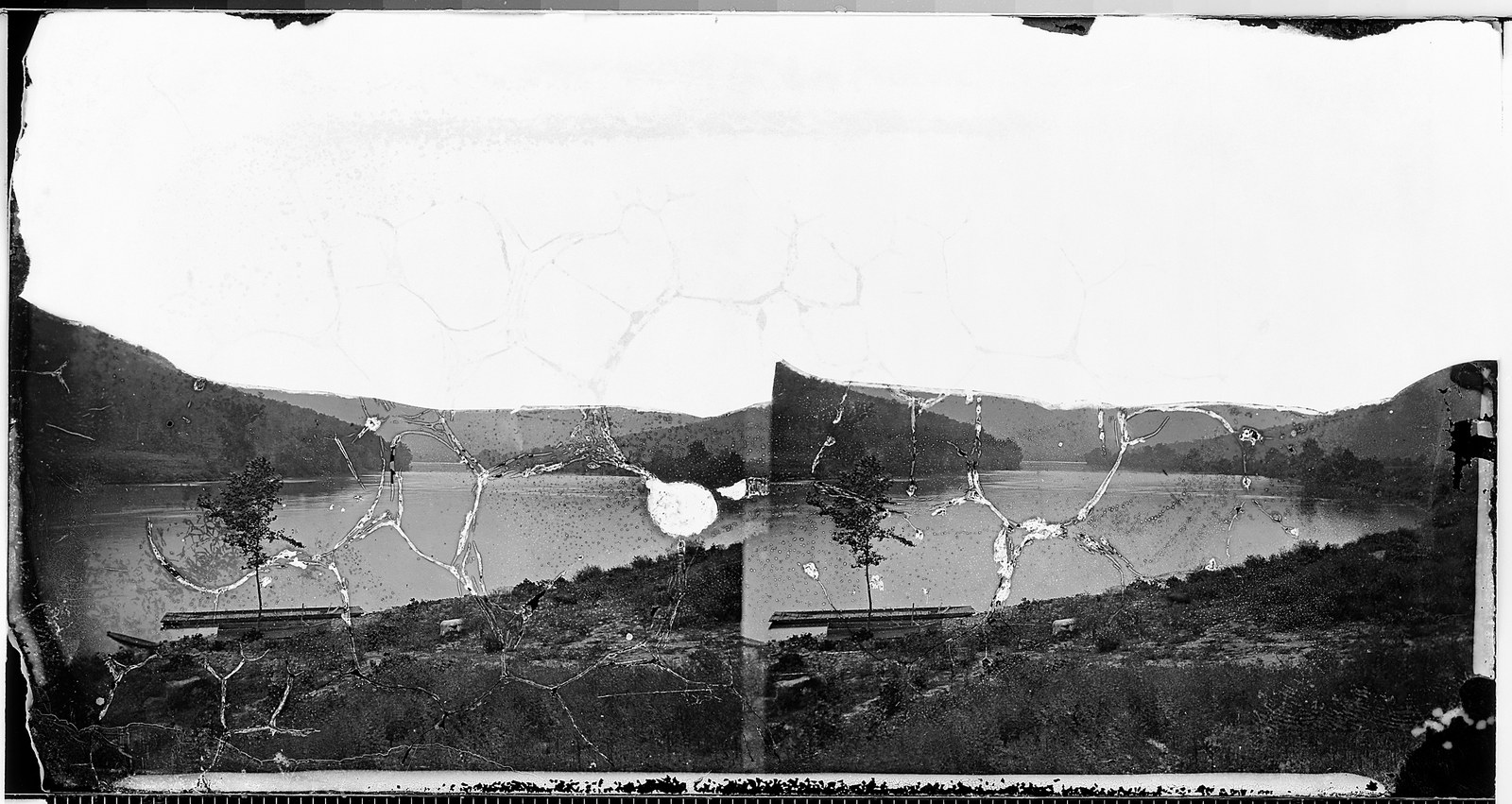
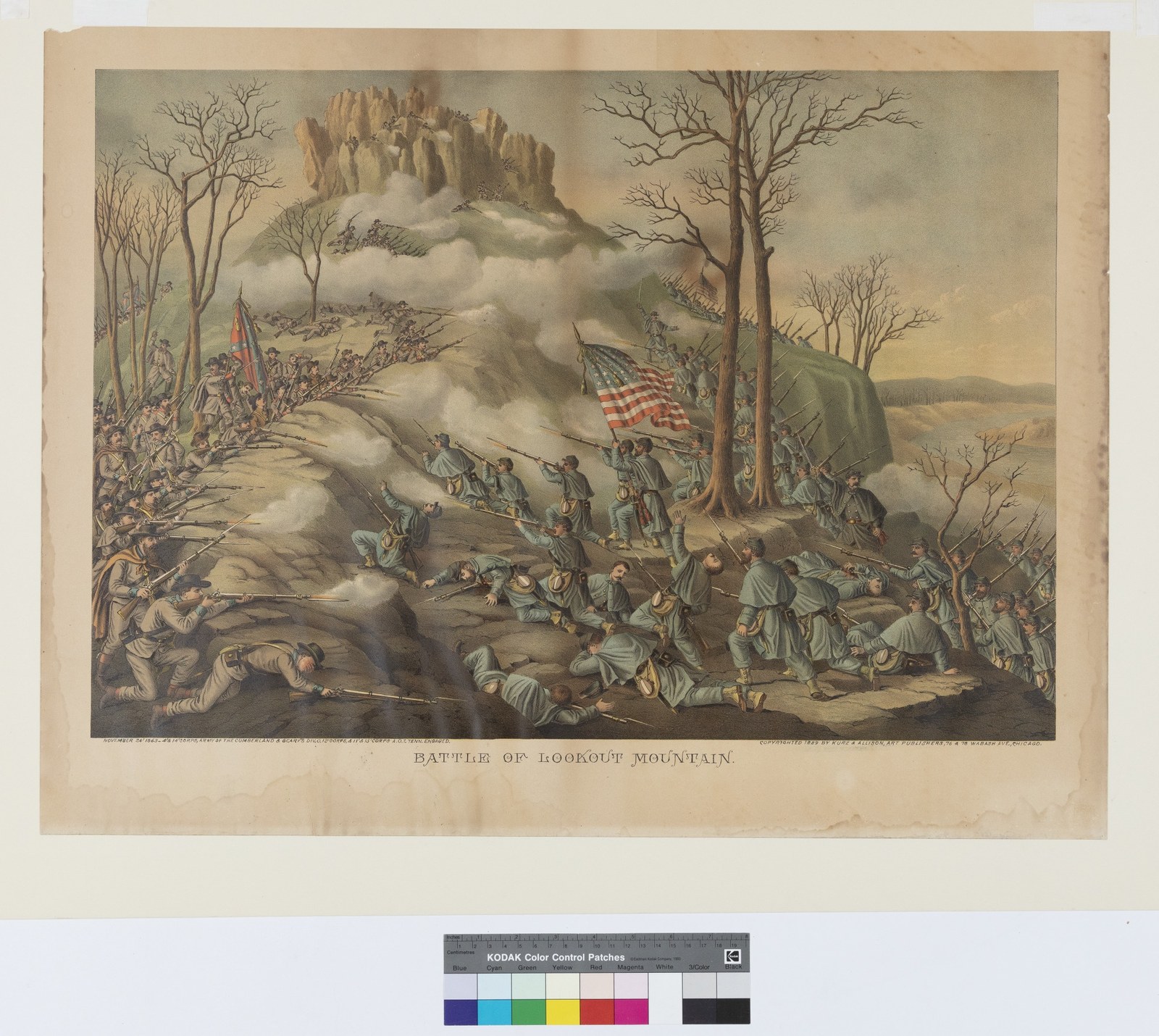
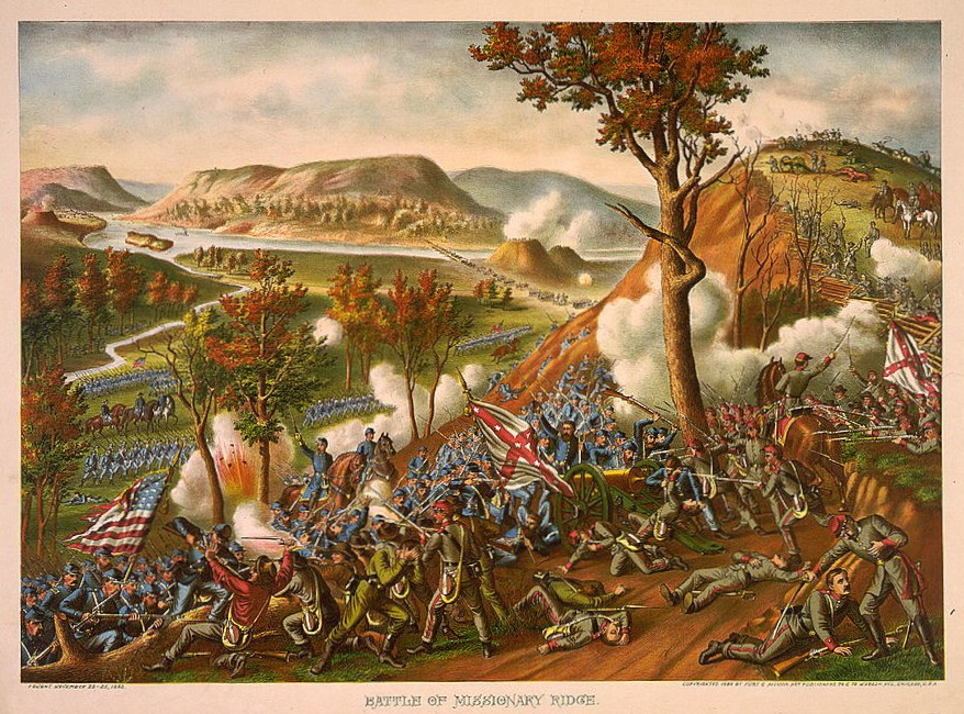
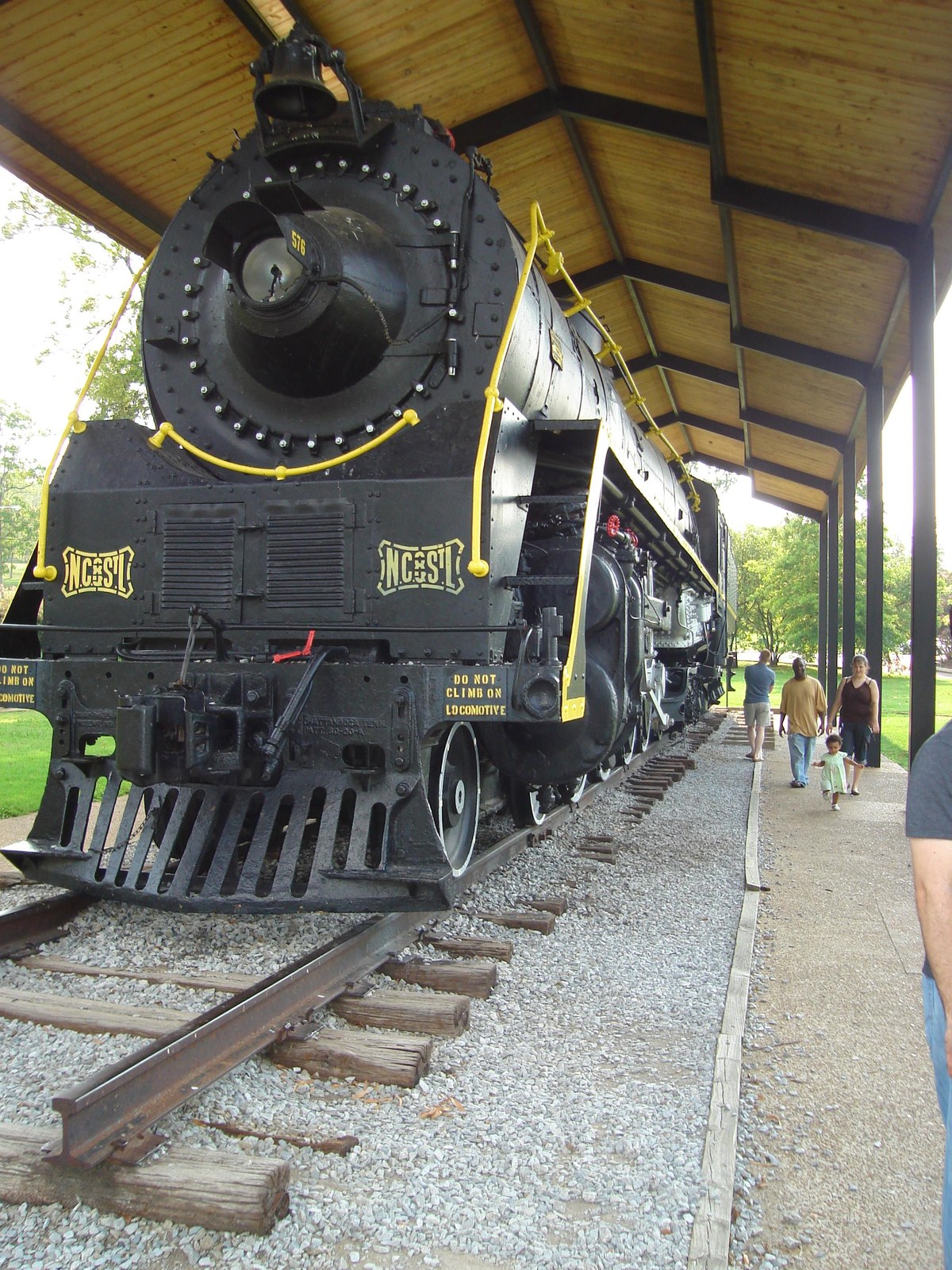
Battle of Lookout Mountain (Nov. 24, 1863): fought just east of Marion County in Hamilton County; Kurz & Allison lithograph.Whiteside Trestle (Jan. 8, 1864): George N. Barnard photograph of the 780-foot Nashville & Chattanooga Railroad trestle at Whiteside, rebuilt by U.S. Military Railroads as part of the Chattanooga supply line. One of the earliest surviving photographs of Marion County.The Siege of Fort McCook (Aug. 27, 1862): Custom regimental movement map showing the Federal garrison at Fort McCook (44th Indiana, 2nd Ohio Artillery, 9th Brigade under Harris) and the Confederate force that crossed at Bridgeport and shelled the fort from the east bank. Map by Carden Brown, 2026, used with permission.Jasper and Vicinity (July 24, 1863): Federal topographical sketch map by Capt. W. E. Merrill, Chief of Topographical Engineers, drawn in the field weeks before the Chickamauga Campaign. Shows Jasper, Bridgeport, Shellmound, Sweeden's Cove, the Battle Creek road, the Sequatchie Valley road, and Lowry's, Alley's, Lover's, and Kelly's ferries. Public domain (Federal-government work). Contributed by Carden Brown.The Suck (1864): Harper's Weekly engraving of The Suck rapid on the Tennessee River, the obstruction at the head of the Tennessee River Gorge that gave Suck Creek its name. The rapids were drowned in the 20th century by Hales Bar and later Nickajack impoundment.Battle of Missionary Ridge (Nov. 25, 1863): fought just east of Marion County in Hamilton County; Kurz & Allison lithograph.NC&StL Railway Locomotive: Industrial era transportationHales Bar Dam (1949): Hydroelectric infrastructureNickajack Dam: TVA hydroelectric projectInterstate 24 (1967): Modern transportation infrastructure near MonteagleScopes Trial (1925): William Jennings Bryan and Clarence Darrow, at a trial presided over by Marion County–born Judge John T. Raulston (Dayton, Rhea County).1927 Christmas Night Shootout marker: Tennessee Historical Commission marker 2B-32 at the corner of Cedar Avenue and Third Street in South Pittsburg, dedicated July 20, 2014, marking the location of the December 25, 1927 gun battle that killed Marion County Sheriff Wash Coppinger and five other officers. Photo: Tyce H.Jasper Commercial Block: Historic downtown architectureHales Bar Dam Powerhouse (2013): The surviving powerhouse from the 1913 dam, now a marina and event venueHales Bar Powerhouse (2017): View from the marina dock; the only major original structure from the Guild-era worksite still standingHales Bar Dam Turbine: Cross-section diagram of one of the dam's eight original turbines (TVA, 1972)Beehive Coke Oven: Interior view of a Sequatchie Valley coke oven at Dunlap, showing the firebrick liningNC&StL Timetable (1930): Schedules for the Dixie Flyer and Dixie Limited passenger trainsShelby Rhinehart Bridge (1981): The "Blue Bridge" carrying SR-156 over the Tennessee River at South PittsburgTrail of Tears Marker, Monteagle (2016): Bell Route marker along U.S. Route 41 on Monteagle Mountain; John Bell's detachment crossed the plateau here in 1838 and camped near Martin Springs on the descent into the Sequatchie Valley
Notable Figures
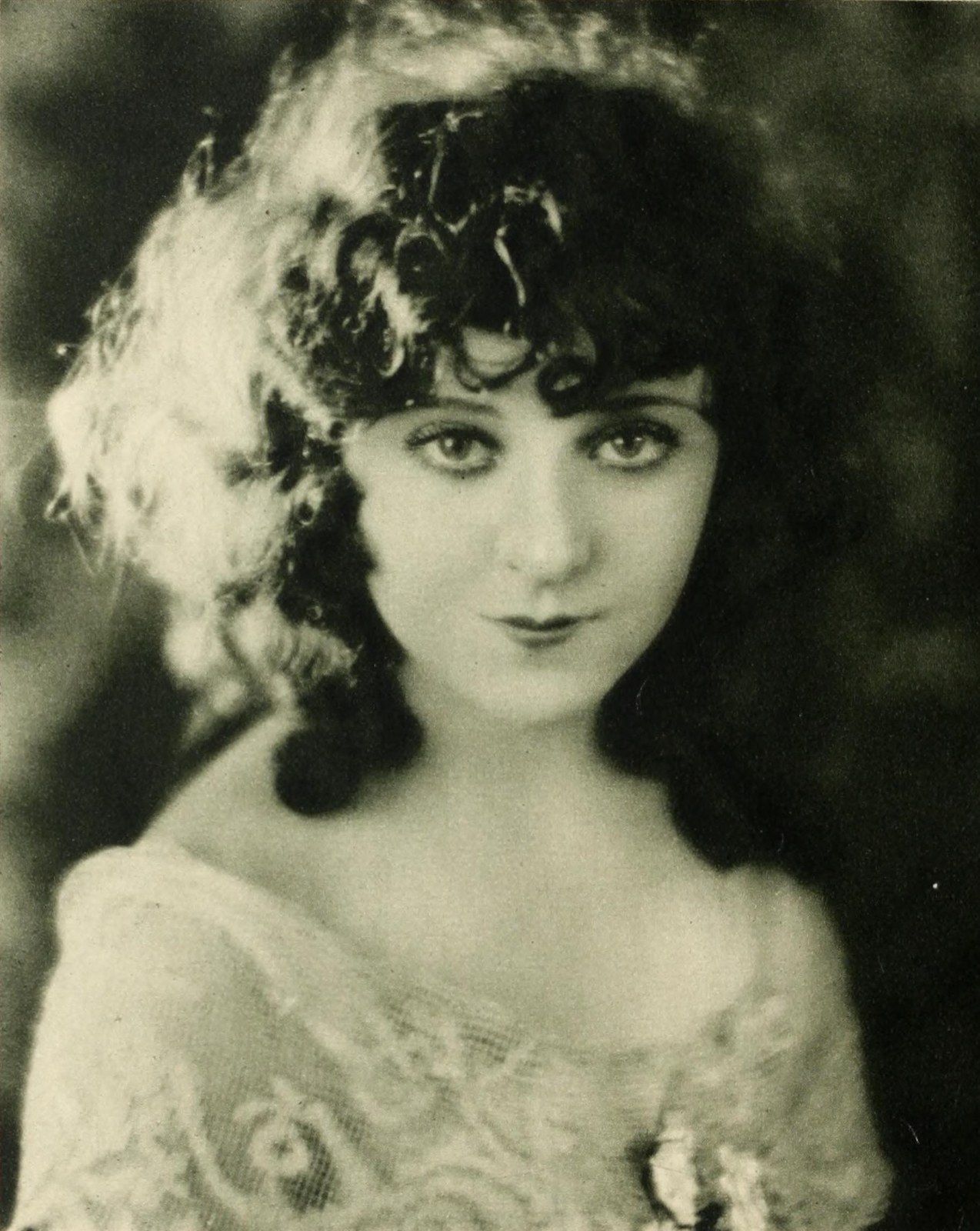
Francis Marion (1732–1795): Revolutionary War hero and county namesakeSequoyah (c. 1770–1843): Cherokee leader and creator of the syllabaryHopkins Turney (1797–1857): U.S. Congressman and Senator from Marion CountyPeter Turney (1827–1903): Confederate colonel, Chief Justice of Tennessee, and Governor of Tennessee (1893–1897), born in JasperJudge John T. Raulston (1868–1956): Judge in the Scopes TrialJames B. Frazier (1856–1937): Governor and U.S. Senator from TennesseeTom Stewart (1892–1972): U.S. Senator and Scopes Trial prosecutor, educated at the Pryor Institute in JasperFoster V. Brown (1852–1937): U.S. Congressman who practiced law in JasperSam D. McReynolds (1872–1939): U.S. Congressman representing Marion County's 3rd DistrictJames Bowron (1844–1928, left) with James A. Farrell: British industrialist who launched Marion County's coal and iron eraJobyna Ralston (1899–1967): Silent-film actress from South PittsburgJacob Saylors (b. 2000): Jasper-born NFL player, Marion County High School #8 retired
Culture & Heritage
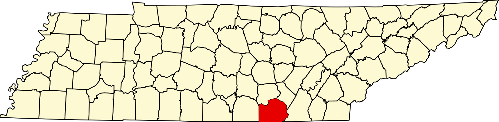
Lodge Cast Iron Skillet: American manufacturing icon since 1896National Cornbread Festival: Celebrating Southern and Appalachian culinary traditionEbenezer Cumberland Presbyterian Church (ca. 1914), near JasperWhitwell Cumberland Presbyterian Church (ca. 1892), Gothic RevivalHales Bar Dam Powerhouse: site of Marion County's most documented hauntingChapel on the Hill (1888 Primitive Baptist), restored sandstone meeting house at Elm Avenue and Eighth Street, South PittsburgOld South Pittsburg Hospital (1959 to 1998), 1100 Holly Avenue, South PittsburgOSPHPRC monument sign at the entrance to the Old South Pittsburg Hospital Paranormal Research CenterMarion County Map: Geographic boundaries and communities
Natural History
Large-flowered skullcap (Scutellaria montana): federally threatened plant of the Tennessee River GorgeBloodroot (Sanguinaria canadensis): an early spring ephemeral of cove forestsFire pink (Silene virginica): scarlet hummingbird-pollinated wildflower of plateau rocky woodsCardinal flower (Lobelia cardinalis): streamside wildflower of late summerPassionflower (Passiflora incarnata): Tennessee's state wildflowerMountain laurel (Kalmia latifolia): a heath of the sandstone rim and plateau bluffsWhite oak (Quercus alba): canopy dominant of Marion County ridgesChestnut oak (Quercus montana): dominant on dry sandstone-capped ridgetopsShagbark hickory (Carya ovata): unmistakable plates of peeling barkRiver cane (Arundinaria gigantea): North America's only native bamboo, now the subject of TRGT restorationMorel (Morchella esculenta): April fruiting under tulip poplar and elmChanterelle (Cantharellus sp.): summer fruiting under oak and beechKudzu (Pueraria montana): invasive vine that transforms Southern roadsidesBald eagle (Haliaeetus leucocephalus): now nesting on Nickajack Lake after 20th-century absenceCerulean warbler (Setophaga cerulea): globally declining canopy songbird of the Tennessee River GorgeWhite-tailed deer (Odocoileus virginianus): recovered from near-extirpation a century agoRiver otter (Lontra canadensis): reintroduced; now established on the Tennessee and Sequatchie RiversEastern hellbender (Cryptobranchus alleganiensis): largest salamander in North America; proposed endangered in 2024Timber rattlesnake (Crotalus horridus): resident of plateau ridges and rocky talus slopesZebra swallowtail (Eurytides marcellus): caterpillars feed only on pawpawLuna moth (Actias luna): silk moth with pale green wings and long hindwing tailsSequatchie caddisfly (Glyphopsyche sequatchie): endemic to four Marion County spring-fed streams, type locality at Sequatchie Cave State Natural Area
Photo Credits & Sources
Kurz & Allison lithographs, Library of Congress
Mathew Brady photographs (Tennessee River Gorge), Library of Congress
Tennessee Valley Authority (TVA) historical photographs, TVA Archives