Last updated: April 23, 2026
Marion County's communities grew where the land and the economy allowed: cities along the Tennessee River and the NC&StL rail line, coal and coke towns on the plateau rim, agricultural settlements on the Sequatchie Valley floor, ridgetop hamlets above the mines, dam-worker villages in the river gorge, and a Chautauqua assembly on Monteagle Mountain. Some thrived into the present; others emptied when the mines closed or the reservoir rose. The places below are grouped by incorporation status and historical role. An additional roster of other named places catalogs the dozens of neighborhoods, flag stops, short-lived post offices, and geographic features that never quite became communities of their own but still show up on Marion County maps and in family memory.
Cities
Three incorporated places chartered as cities: a Nickajack Lake community on the southern end of the county, an industrial river town that grew up around coal, iron, and cast iron, and a coal-country valley town on the Sequatchie River.

New Hope
Originally called Antioch, incorporated in 1974 to resist annexation. Sits along Nickajack Lake near Nickajack Dam (107 MW).
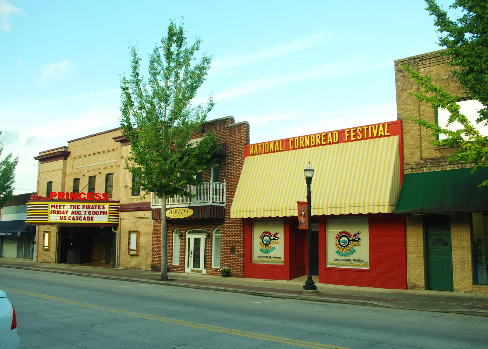
South Pittsburg
Industrial city on the Tennessee River, home to Lodge Cast Iron since 1896 and the National Cornbread Festival since 1997. Founded by British investors in 1876.

Whitwell
A coal town named for British metallurgist Thomas Whitwell. Home of the Paper Clips Project (1998), a Holocaust memorial that collected over 30 million paper clips.
Towns
Five incorporated towns, including the county seat of Jasper, a mountaintop Chautauqua resort, a planned city that collapsed in the Panic of 1893 and reopened as a retail hub, and a former coal-camp town of 87 people.
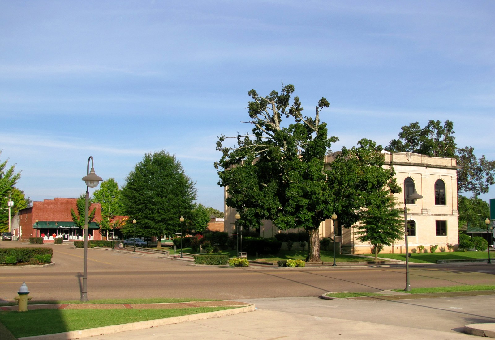
Jasper
County seat since 1819 and home to 3,612 people. Founded on land purchased from Betsy Pack, Jasper survived a devastating 1922 courthouse fire and remains the civic heart of the county.

Monteagle
A mountain town founded as a Chautauqua assembly and summer destination, Monteagle blends religious heritage with Appalachian culture.

Kimball
A $2.5 million planned city that collapsed in the Panic of 1893, reborn as the county's retail hub at the I-24 / U.S. 72 interchange.

Powells Crossroads
The southeastern gateway to the Sequatchie Valley, along Suck Creek Road; named for WWI veteran Foster Powell.

Orme
One of Tennessee's smallest incorporated towns (2020 pop. 87). A former coal-camp town that made national news in 2007 when it ran out of water.
Unincorporated Communities
Rural crossroads, river landings, and valley-floor neighborhoods that never incorporated but carry their own histories, from ancient shell middens at Shellmound to the dam-worker housing at Haletown and Guild.

Haletown & Guild
River communities built to house Hales Bar Dam workers in the early 20th century; now rural lakeside neighborhoods.

Shellmound
A historic community on Nickajack Lake, named for the ancient freshwater shell middens that marked indigenous occupation along the river.

Battle Creek
A rural community and creek drainage on the western side of the county, with Cherokee-era roots, early Anglo-American settlement along the bottomlands, and a long association with conflict.

Sweetens Cove
A pastoral valley community with a historic Primitive Baptist church, a Civil War battlefield, and the Sweetens Cove Golf Club.

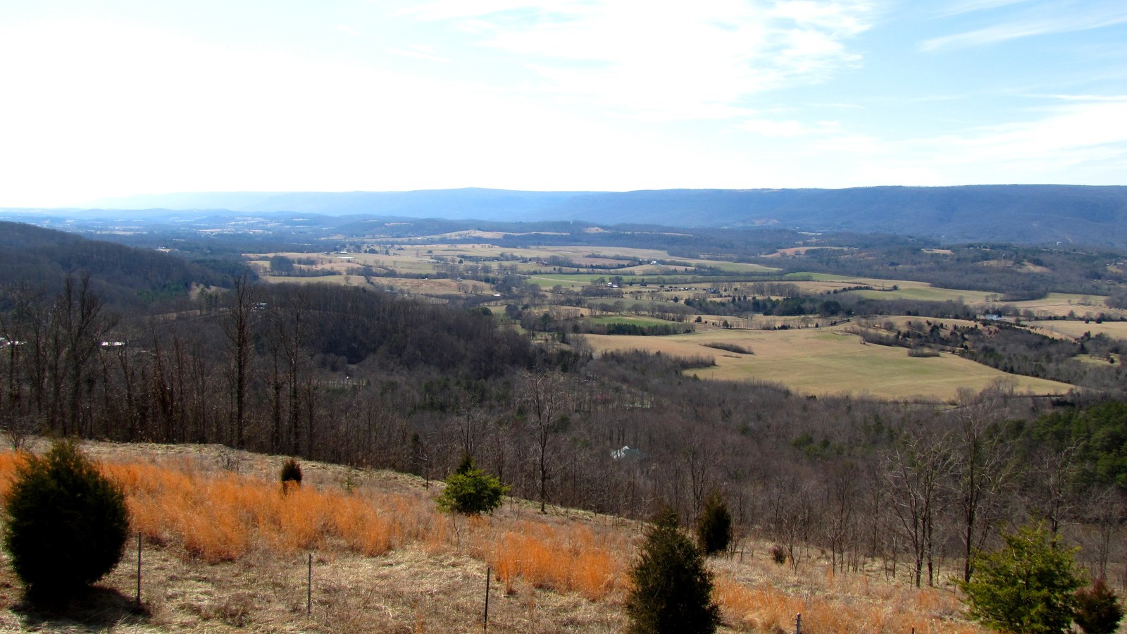
Sequatchie
A small CDP (pop. 622) along the Little Sequatchie River, not to be confused with Sequatchie County, carved off in 1857.

Coppinger Cove
A secluded plateau-escarpment cove named for an Irish-immigrant family, with caves, a Baptist church, the Sequatchie Cove Creamery, and the 1927 Christmas-night shootout that killed Sheriff G. W. Coppinger.

Ebenezer
A Sequatchie Valley farming community three miles from Jasper, anchored by the ca. 1830 Ebenezer Cumberland Presbyterian Church, the first Cumberland Presbyterian congregation in the valley.

Whiteside
A Raccoon Mountain railroad community where the 1854 Nashville & Chattanooga line crossed the Running Water ravine on a 780-foot wooden trestle. Known successively as Running Water, Etna, and Whiteside.
Mullins Cove
A Tennessee River Gorge cove on the north bank, settled by the Long family between 1807 and 1811. Long Cemetery #2 sits partially submerged under the Nickajack Lake pool.

Aetna
A Cumberland Plateau hamlet named for Sicily's Mount Etna, where the Etna Mines of 1852 helped produce the bulk of Tennessee's coal before the Civil War. The 7,400-acre River Gorge Ranch development, begun in the early 2020s, is reshaping the mountaintop.

Martin Springs
A small community at the head of Battle Creek in northwestern Marion County. John Bell's Cherokee detachment camped here October 23-26, 1838 during the forced removal west.

Mount Olive
A ridgetop community on the Cumberland Plateau above Whitwell, grown out of the coal-and-coke corridor of the Sewanee Coal, Coke and Land Company and still scattered along Mount Olive Road.

Griffith Creek
A Cumberland Plateau Census-designated place on TN-108 between Palmer and Whitwell, named for an early Marion County settler family. Population about 405 at the 2020 ACS.
Jasper Highlands
A gated mountaintop residential development on Jasper Mountain above the town of Jasper, begun in 2008 by Thunder Enterprises; about 1,300 of 1,600 planned lots sold by the early 2020s.

Ladds Cove
A Battle Creek headwaters cove on the south slope of Monteagle Mountain, named for Ladd-family settlers. Not to be confused with Ladd, the Hales Bar Dam worker village.

Mineral Springs
A small unincorporated community on the Sequatchie Valley floor whose name ties it to Tennessee's 19th-century mineral-springs resort era, though institutional records for a Marion County resort are thin.

Suck Creek
An unincorporated community on the Marion-Hamilton line inside the Tennessee River Gorge, along TN-27, named for “The Suck,” a vanished rapid that once churned the river here.
Historical Communities
Company towns, Cherokee settlements, and speculative ventures that once thrived but are now remembered through ruins, family histories, and restored sites.

Victoria
Originally called Dadsville, renamed in 1877 when British capital and the NC&StL railroad arrived. Victoria's beehive coke ovens fed the South Pittsburg blast furnaces.
Inman
TCI's iron-ore mines, probably named for financier John H. Inman. Supplied brown ore to South Pittsburg's blast furnaces; site of an 1892 convict labor revolt.

Richard City
Dixie Portland Cement company town (1906), built entirely of the plant's own cement product. Renamed for president Richard Hardy in 1914, annexed by South Pittsburg in the 1980s.

Rexton
Named for investor "Rex" Kilpatrick, Rexton was a planned coal town in King's Cove. A hotel and 35 cottages went up, but thin coal seams and a flood ended the venture by 1912.
Battle Creek Mines
The 1869–1876 post-office community at the mouth of Battle Creek that became South Pittsburg. Built around the 1854 coal mine, Tennessee's fifth. Name revived in 1905 at Orme as the Battle Creek Coal & Coke Company.
Cheekville
The pre-1877 name for the upper Sequatchie Valley settlement that became Whitwell. Site of Marion County's first court session in 1817, at the home of John Shropshire. Renamed when British capital arrived in 1877.
Shake Rag
An abandoned coal-camp company town of the McNabb Mines on the southern end of Walden's Ridge in the Tennessee River Gorge. Operated 1880s–1905; stone ruins survive in Prentice Cooper State Forest. On the National Register of Historic Places since 2008.

Raulstontown
South Pittsburg Mountain hamlet of the Raulston family, with Civil War fortifications at Tom Ellis's old home and Red Cut Hill, the 1829 pioneer cemetery near Whitacre Point, and the home of John T. Raulston, the Marion-County-born judge who presided over the 1925 Scopes Trial.

Condra
An upper-Sequatchie-Valley hamlet of the Condra family along TN-28, with the Sequatchie Valley Branch Railroad's Condra Switch and family-business ties to the Whitwell area (Cedar Springs PO 1874, John Condra Store, J. E. Condra Blacksmith Shop).
Red Hill
A small upper-valley community north of Whitwell on the old Dunlap Highway, anchored by Red Hill community church and the 1,343-memorial Red Hill Cemetery, one of the larger rural cemeteries in the upper county.

Nickajack & Running Water
Cherokee Lower Towns founded by Dragging Canoe in 1779. Destroyed by Major James Ore's unauthorized 1794 militia raid, ending the Chickamauga Wars and opening the valley to Anglo-American settlement.

Hale's Bar Village
The 1905-1913 construction camp that housed more than 5,000 workers, three shifts a day, while Hales Bar Dam was built on the Tennessee River. Sometimes called “Sucktown” in period reporting.

Kelly's Ferry
A vanished Tennessee River crossing in western Marion County, named for John Kelly (1779–1845). Best known as the river end of the 1863 Cracker Line that broke the Confederate siege of Chattanooga; the ferry ran until 1952.

Ladd
The south-bank Hales Bar Dam worker village along TN-156 at the base of Ladds Mountain, across the river from Guild. Not the same place as Ladds Cove near Monteagle.
Other named places
Neighborhoods inside the towns, railroad flag stops, short-lived post offices, coves, ridges, and landings that appear in maps, ledgers, and family records without quite becoming communities on their own.